Hawker to Blinman
Hawker to Blinman Self Drive Experience.
A suggested easy drive from your Hawker base via 111 km bitumen road to the historic old copper mining town of Blinman.
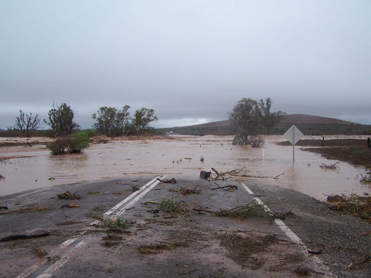
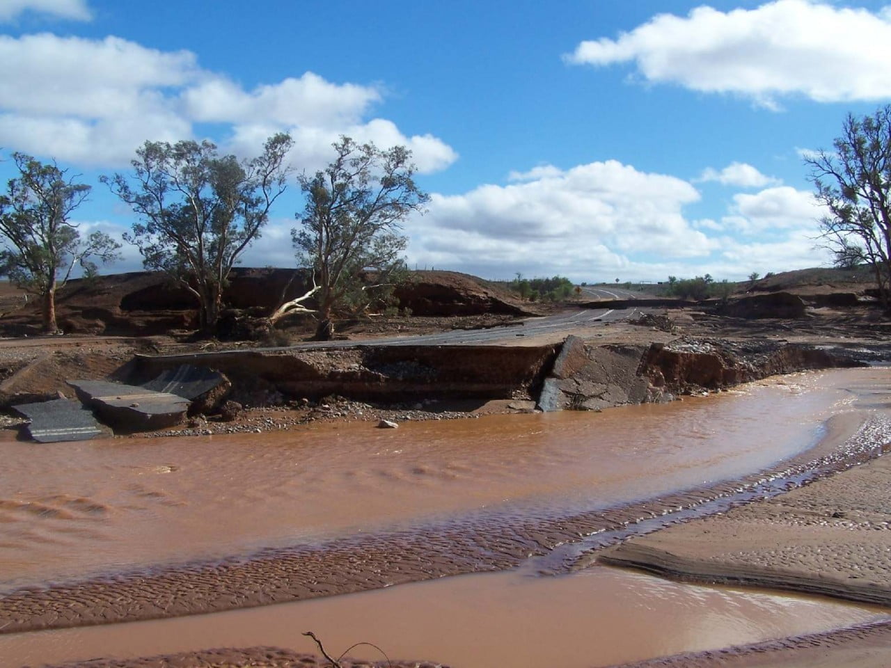
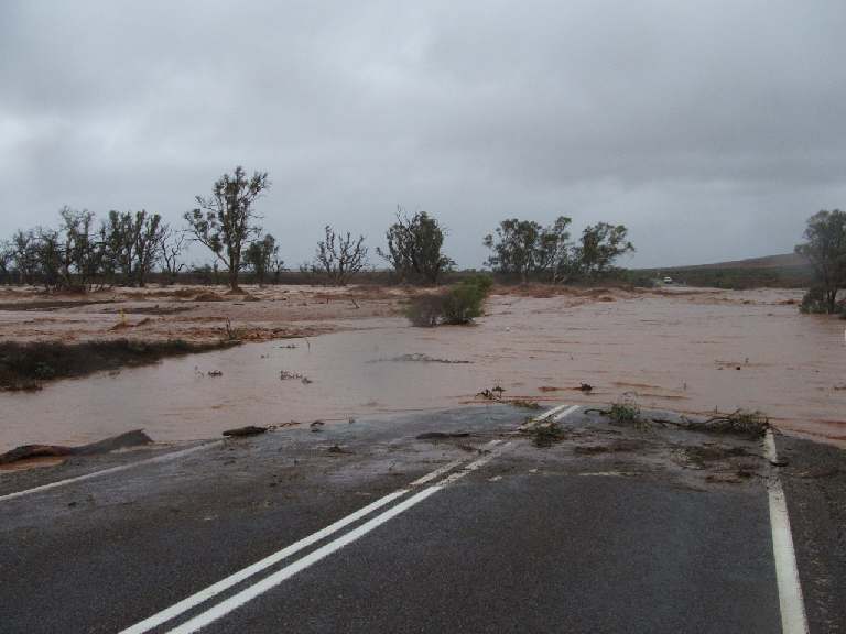
North of Hawker approximately 4 kms is the Wonoka Creek, this creek is a drainage creek from Willow Plains and towards Cradock area. In January 2007 173 mm of rain fell on the Hawker area with even more recorded near Cradock.
-

- Wonoka Creek
-
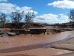
- Wonoka Creek
-
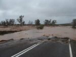
- Wonoka Creek
5 Kms from Hawker you will pass the Hawker Airport. The Hawker Airport is a sealed airstrip with lighting and airport building, it is used by the Royal Flying Doctor Service ( RFDS ), scenic flight tour operators and tour groups visiting the area.
After leaving Hawker 10 kms north, on the left, the ruins of an old building will be seen, this is known locally as the dairy farm. In this area there was also a blacksmith, eating house, store and other buildings. On the right side of the road can be seen the old North Arkaba church which was also used as a school, the church was abandoned in 1955.
Further along the road on the left at approximately 21 kms is the Arkaba Station Woolshed, this woolshed was built in about 1856. Early morning is the best time to photograph this building.
Travelling on about 2kms is the Arkaba lookout, a small rise near the left side of the road, here is a good spot for a photograph with the Elder Range in the back ground and the hills of Arkaba and a small prominent hill known as the “Sugarloaf” (Little Mt Fuji) in the foreground.
About 28 kms from Hawker is the turnoff to the Moralana Scenic Drive, this drive is an unsealed road about 28 kms in length, linking the Hawker to Blinman road to the Hawker to Leigh creek road. Click here for the Moralana Scenic Drive page.
The next lookout is the Elder Range lookout approximately 1km further north on the right this is also a good location for an early morning photo of Elder Range. At this point travelling towards Blinman the Chace Range is on your right, Elder Range on the left and towards the north Wilpena Pound.
Travelling on further is the Rawnsley Park turnoff, 35 kms from Hawker. Just north of the Rawnsley turnoff on the right is the Martins Well road turnoff which is also the road to Pugilists Hill a higher lookout point.
The next point of interest on this drive is Arkaroo Rock Aboriginal Paintings. Turn off left at the sign and drive towards the Wilpena Pound Range for about 2kms to the carpark. Read the signs and follow the walking trail to the rock. The walk is about one hour each way. The sheer rock faces on the Wilpena Pound wall, when looking left from the car park, are known as Moonarie, this is a popular place for experienced, well equipped rock climbers.
When back on the Hawker to Blinman road about one hundred metres north on the right from the Arkaroo Rock turnoff is a carpark and the Rawnsley lookout, from here you have a clear view of the Pound wall, showing Rawnsley Bluff, and the Chace Range. There is seating available and it is an ideal morning tea location.
A short distance north of Arkaroo lookout is the boundary of the Flinders Ranges National Park. This is not the start of the Flinders Ranges, they actually start near Crystal Brook. As you travel through the National Park there is usually plenty of wildlife to see. The next turnoff to the left is into the Wilpena Pound Resort and the Old Wilpena Station.
About ½ km past Wilpena Pound turnoff is the left turn into Cazneaux’s Tree, named after the photographer Harold Cazneaux who photographed the tree in 1937 with Wilpena Pound in the background. Harold Cazneaux is the grandfather of well known Australian business man Dick Smith. He titled his photograph “Spirit of Endurance”. To view his photo click here.
About 1km past the Wilpena Pound turnoff is a dirt road off to the right which goes to Sacred Canyon. The road winds its way through creeks and low hills for 14kms to a car park, from there you must walk to view the rock carvings.
The next turnoff which is about 5 kms north of Wilpena Pound turnoff is a dirt road to Bunyeroo Gorge, this is the best way to go to see Bunyeroo Gorge because you travel down the Razorback. If you approach from the other direction you must drive up the Razorback and the scenery is behind. Click here for Bunyeroo Gorge details.
Travelling a further 5 kms towards Blinman on your left is the turnoff to Hucks lookout, this is an ideal photo point shooting your camera down the valley with the Wilpena to Blinman road in the foreground.
The next lookout is 2 kms north, this is Stokes Hill lookout. Turn right onto the Stokes Hill road and climb to the top of Stokes Hill 750 metres. From here is a clear view of Wilpena Pound, Heysen, ABC and Chace Ranges. Looking east to north east you take in the view of the Bunkers and Love Mine Range. A cast layout of Wilpena Pound showing points of interest is in the carpark.
Just 1 km on from Stokes Hill turnoff is the turnoff to Willow Springs, which offers accommodation, bush camping, guided tours and is home of SKYTREK a four wheel drive track. Skytrek can be done in your own 4wd or as a passenger in a tour vehicle. Costs apply. Click here for links to the pages Accommodation, Camping, guided tours and Skytrek.
Another 3 kms north on the right is the turnoff to Arkaroola, Bunkers Barytes Mine, Wilkawillina Gorge and Wirrealpa Station. The road to Blinman continues straight on.
About 2 kms on is the turnoff to Appealinna Ruins this turn off is to the left. The ruins are 2 kms from the Hawker to Blinman road. Appealinna homestead was built on the south side of the creek in the 1850s, by pastoralist Joseph Wills. The buildings on the north side of the creek are the remains of a once a busy mining settlement.
The road continues north towards Blinman, a further 6 kms on the right is Oraparinna, once the station homestead of a pastoral property and now homes, office and workshop for the National Parks.
North of Oraparinna by 3 kms is a camping area known as Dingly Dell, people camp overnight here, a camp permit is required.
Just north of Dingly Dell is the Enorama Creek and the Brachina Gorge turnoff. Please click here for more information.
Continue a short distance to the Perawurtina Cultural Heritage Site. Signage in the car park explains the significance of the area.
Continue north, approximately 13 kms is the turnoff on the left to Gum Creek Station, which offers self contained accommodation.
After some distance north and closer to Blinman the range on the right will take on the appearance of what is locally known as the “Great Wall of China” The highest point is known as Mount Emily, 707 metres high.
Approximately 6kms from Blinman is the entrance to Alpana station. Alpana station offers self contained accommodation, camping, self drive four wheel drive (4WD) tracks and guided 4wd tours.
3kms from Blinman is the turnoff to the right for Angorichina Station, Wirrealpa Station, Chambers Gorge, Mulga View station and on to Arkaroola Sanctuary.
Next is Blinman, a small country town with a hotel, shop, accommodation and the historic Blinman Mine and mine tour.